
De Bry Rare Books
Linschoten - 1596 - "Exacta & Accurata Delineatio cum Orarum Maritimarum tum etjam locorum terrestrium quae in Regionibus China, Cauchinchina, Camboja sive Champa, Syao, Malacca, Arracan & Pegu..."
Linschoten - 1596 - "Exacta & Accurata Delineatio cum Orarum Maritimarum tum etjam locorum terrestrium quae in Regionibus China, Cauchinchina, Camboja sive Champa, Syao, Malacca, Arracan & Pegu..."
Couldn't load pickup availability
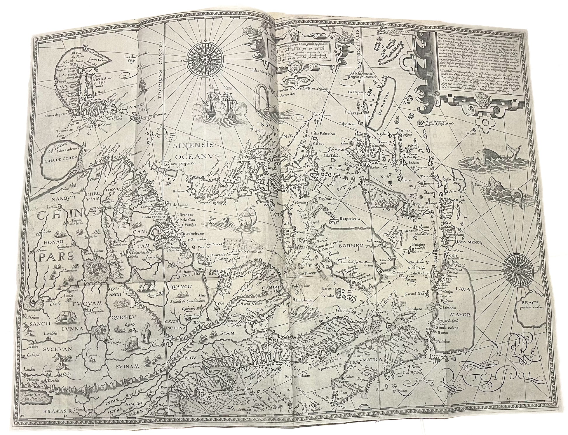
"Exacta & Accurata Delineatio cum Orarum Maritimarum tum etjam locorum terrestrium quae in Regionibus China, Cauchinchina, Camboja sive Champa, Syao, Malacca, Arracan & Pegu"
-Jan Huygen van Linschoten
-1596
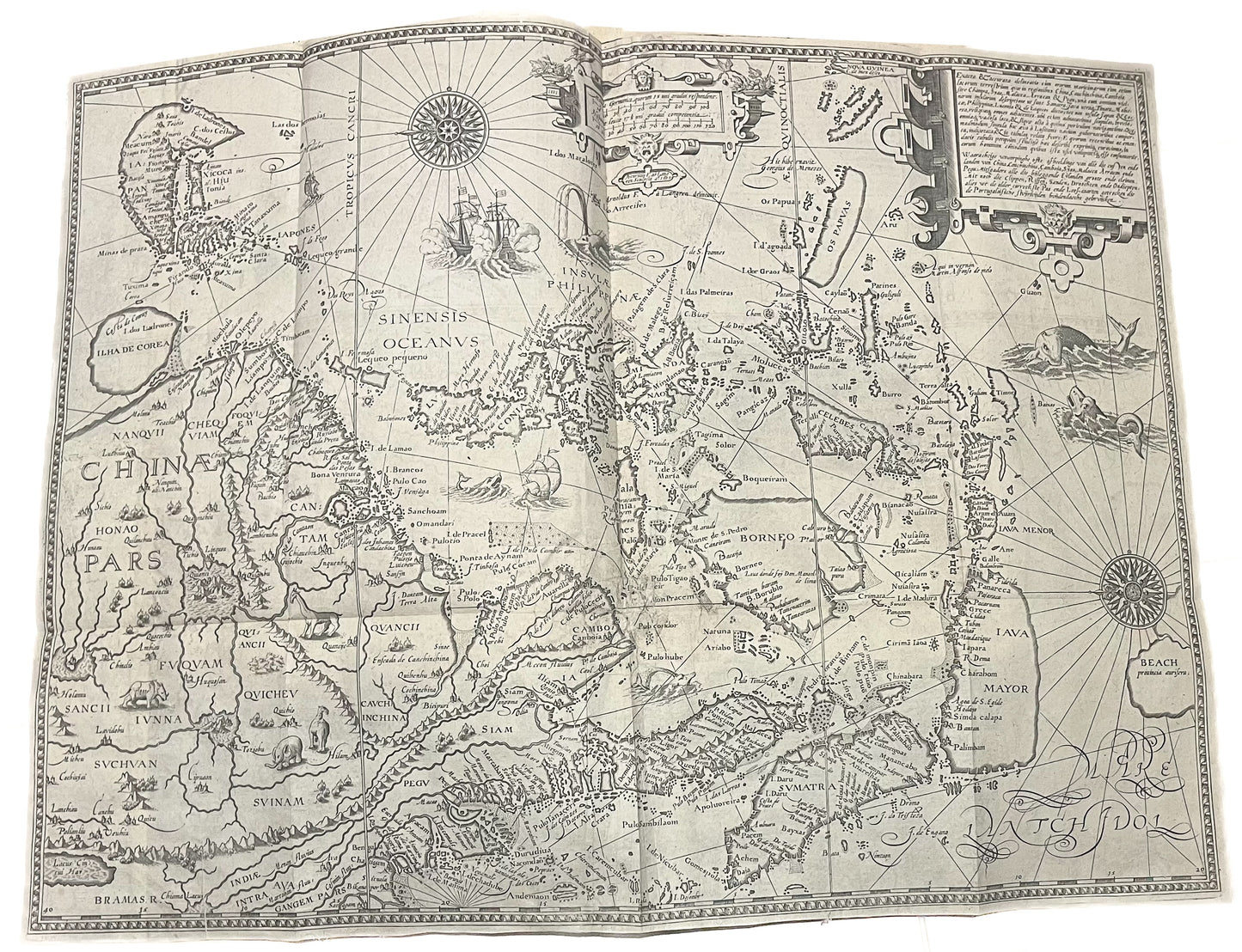
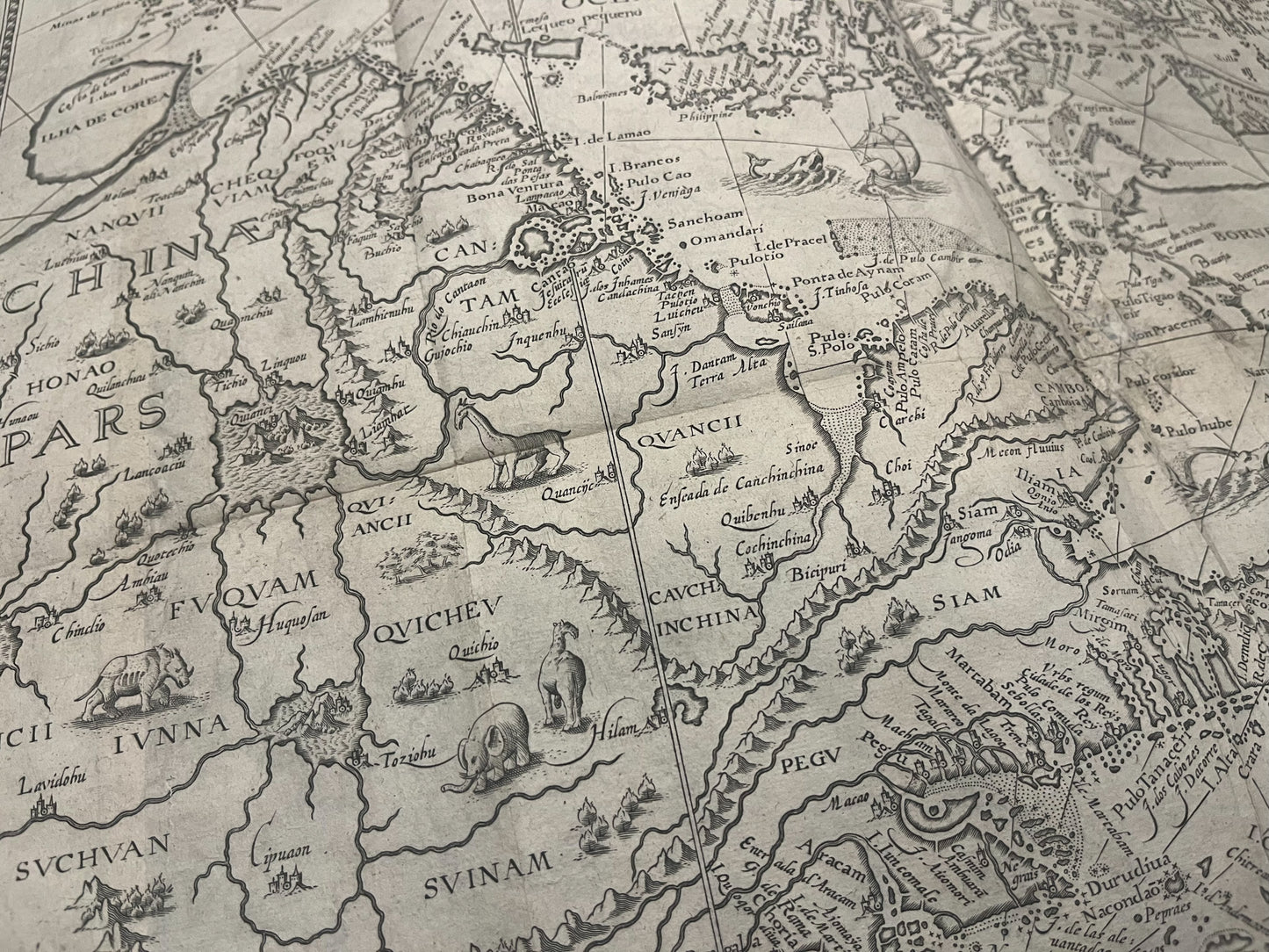
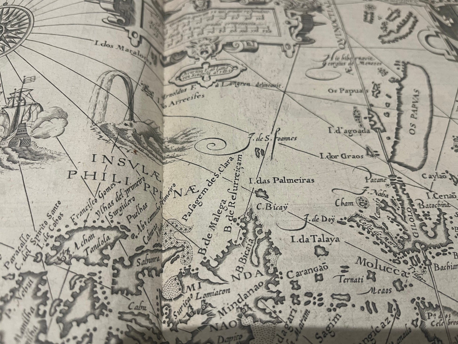
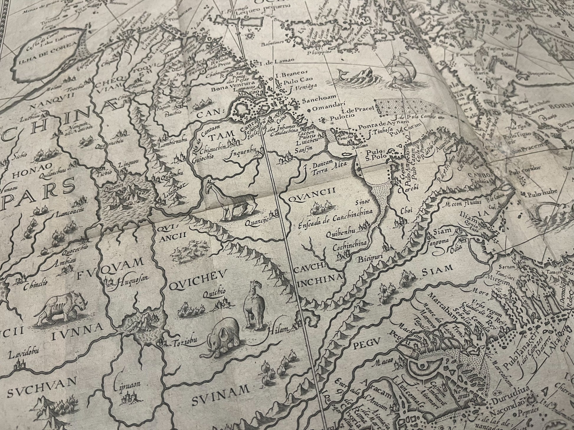
-The map depicts South East Asia including Japan, China, Singapore, Malaysia and Thailand.
-Beautiful 16th Century map egraved by Arnold Florent van Langren
-Very good condition - with repair at centrefold with minor loss
-Folds (as issued)
-Uncoloured (most copies on the market have modern colour which can detract from how it would have been produced at the time).
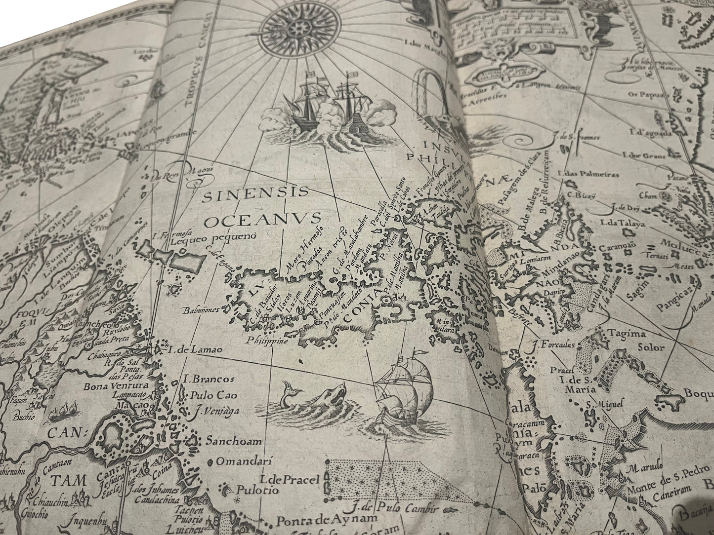
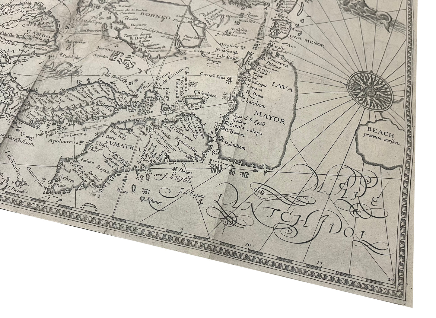
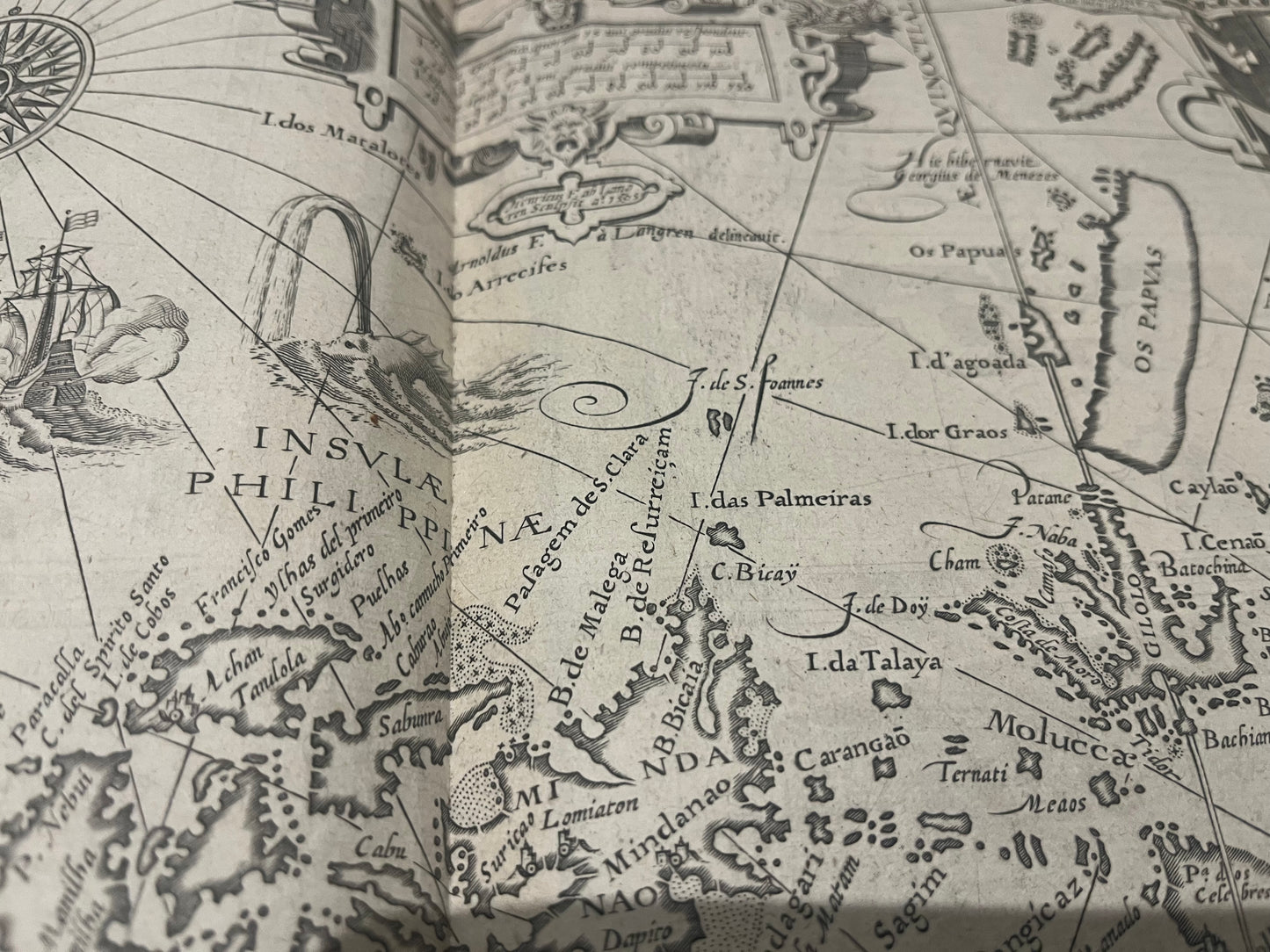
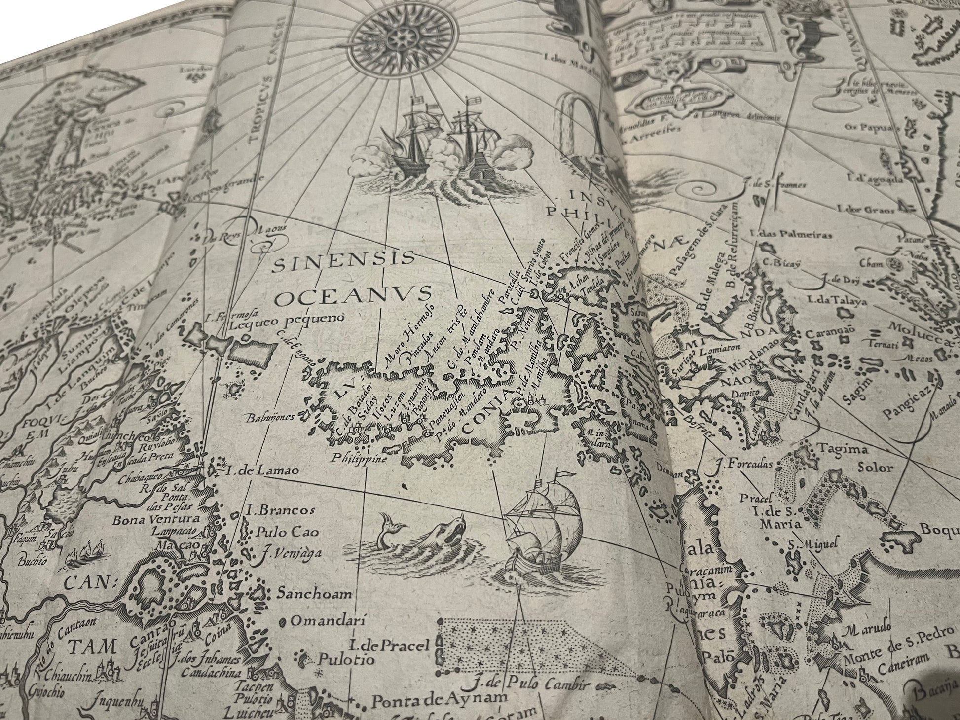
This iconic map was drawn from Secret Portuguese charts, which were obtained by the Dutch. The chart is beautifully engraved, and contains depictions of Giraffe, Camels, elephants and a rhinoceros. Two ships in full sail fire their cannons while a whale shoots water from its blowhole. Delicately engraved cartouches show the title and a scale of distance, while two compass roses decorate the ocean.
The chart is orientated from West to East and shows SE Asia at is was known at the time. Japan is shown in its "Shrimp" shape, with the port of Nagasaki well portrayed but the rest of the Island little known. Korea is tentatively depicted as an Island, but sand banks are shown connecting it to the mainland to demonstrate the uncertainty over its true status. On the mainland, China is shown with several rivers and lakes, as based on local Chinese myths. Australia, little known at this time, is shown as the island "Beach" which originates in Marco Polos suggestion of a great Southern Continent.
Linschoten (1563-1611), a young Dutch man, sailed to Goa in 1583 as the Secretary to the Archibishop of Portuguese Goa. Having grown up in Enkhuizen in Holland, he moved to Seville and then Lisbon as a teenager to be with his elder bothers. He learnt the languages, and the ways of a merchant, before taking the opportunity to sail to Goa. Once there, he wrote a journal of his experiences which vividly described life in India. He not only described day to day life of the Portuguese living there, but also described the peoples, the flora and fauna and the surrounding region.
On his return he was encouraged to publish his account, the famous "Itinerario", which was embellished with entries from a knowledgable local doctor, Paludanus, and 6 beautiful maps. Linschoten would later sail to the Arctic with Barentz, famously overwintering there with his crewmates when the ship became trapped in the ice. In his later years he became town treasurer to Enkhuizen, where he died in 1611.