

De Bry Rare Books
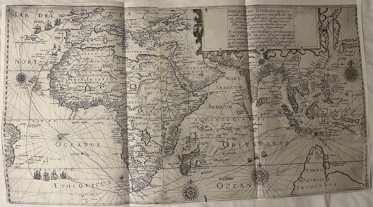
"Descriptio Hydrographica accommodata ad Battavorum navagatione in Javam insulam Indie Orientalis." Houtman 1599
"Descriptio Hydrographica accommodata ad Battavorum navagatione in Javam insulam Indie Orientalis." Houtman 1599
Couldn't load pickup availability
"Descriptio Hydrographica accommodata ad Battavorum navagatione in Javam insulam Indie Orientalis."
Large engraved map on 2 sheets c.350 x 665mm.
Theodore De Bry
1599
Published in Part 3 of De Bry's Petits voyages
Large 2 sheet map of Africa and Asia depicting from the east coast of Brazil to Japan. The map charts the pioneering first Dutch voyage to the East Indies by Houtman. This important voyage from 1595 to 1597 was the first Dutch expedition to the East Indies. It was the first to Establish the Dutch spice trade and break the Portuguese monopoly of trade with the East. Large title cartouche upper centre of right sheet, ships, compass roses and rhumb lines. Small repair to tear at centre with tiny area of facsimile. Repair to tear on left of image. Otherwise professionally restored and very good map. Uncoloured (as would have been issued) unlike many copies which have modern colouring.