DeBryRareBooks
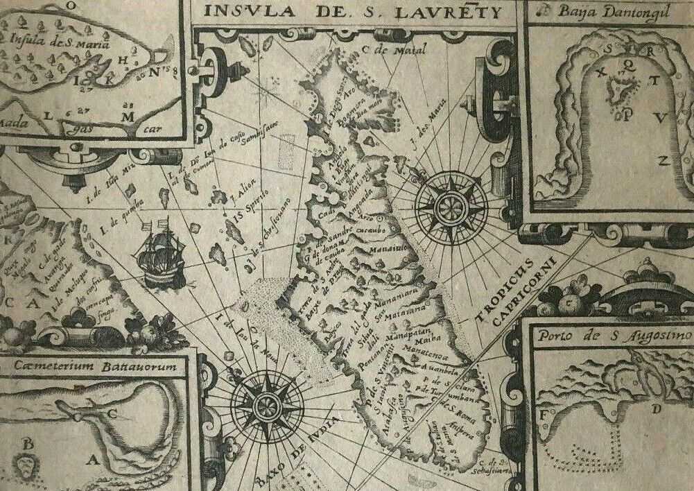
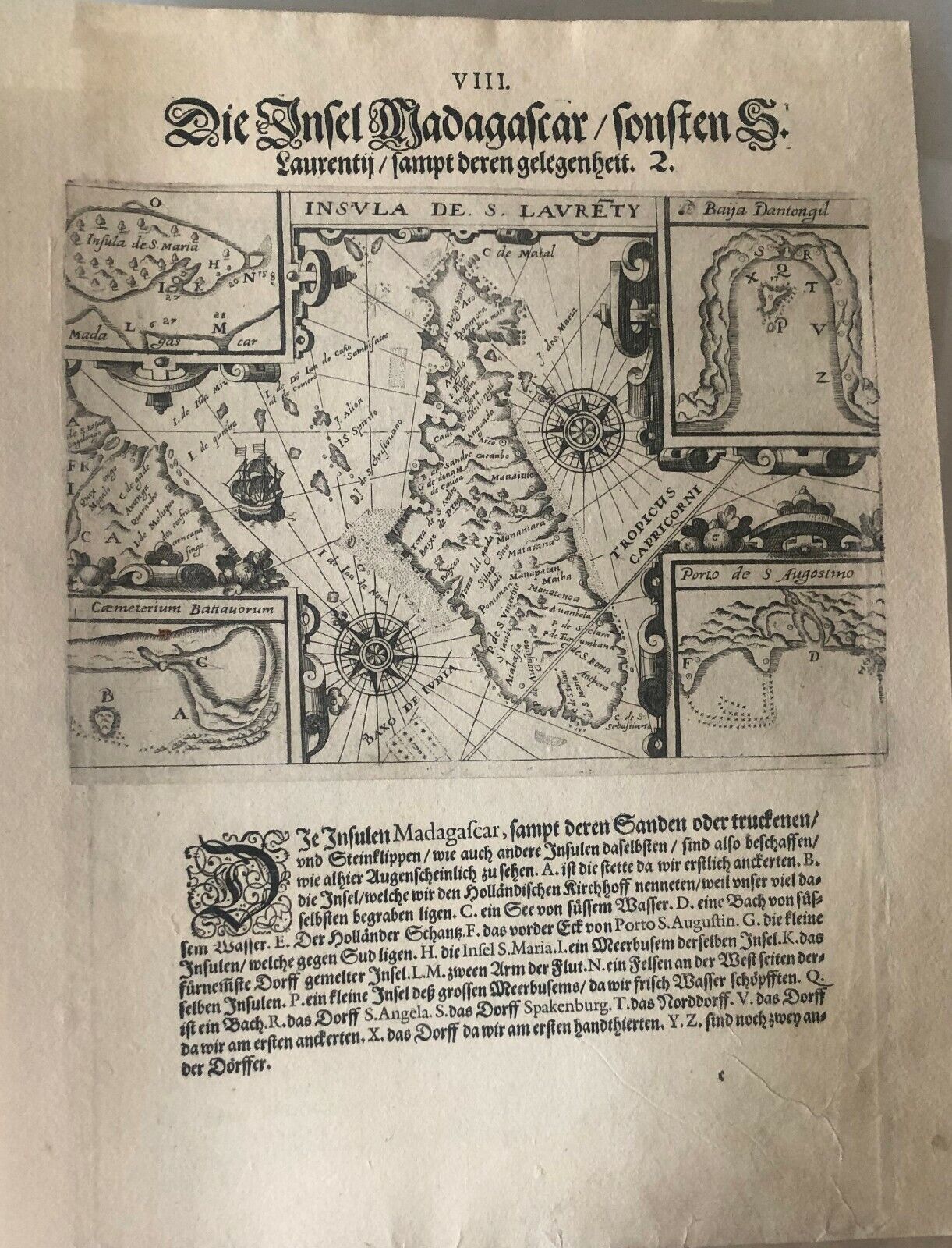
De Bry - "A map of the island of Madagascar" - 1599 - Africa
De Bry - "A map of the island of Madagascar" - 1599 - Africa
Regular price
£150.00 GBP
Regular price
Sale price
£150.00 GBP
Unit price
per
Tax included.
Shipping calculated at checkout.
Couldn't load pickup availability
"The Island of Madagascar (St Laurence)"
-Original Copperplate Engraving from 1599
-Johan Theodore De Bry
-Image 14x10cm
-Page 29x19cm
-Page 29x19cm
-Good condition - the image has been professionally restored with restoration of the lateral margins on both sides of the image
-Verso blank
This original engraving comes from part 3 of the De Bry's Petits Voyages. Alongside a description of the Arctic by barents, this part described Linschoten's voyage to India.
This is plate 8 from the work: "The Island of Madagascar (St Laurence)". The text reads:
"Madagascar is drawn here, with its sands and rocky cliffs: “A” is the place where we first anchored, “B” Is the island where many of the Dutch sailors were buried, “C” a fresh-water lake, “D” a stream of fresh-water, “E” the Dutch trench, “F” the corner of the port of St August, “G” A small island to the south, “H” The island of Santa Maria, “I” A convenient cove of Santa Maria, “K” The most important village of the island, “L” & “M” The two arms of the river, “N” A rock on the west side of the Island, “P” A small island in the cove for fresh water, “Q”, A stream, “R”, The village of St Angela, “S” The village of Spakenburg, “T” The village in the north, “V” The village where we first anchored, “X” Where we first manoeuvred, “Y” & “Z” Two other villages."

